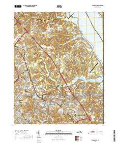
2019 Map of Williamsburg
USGS Topo · Published 2019About this map
Williamsburg is the focal point of this coastal Virginia study, revealing a landscape where colonial heritage and modern development meet. The city center is anchored by the historic College of William and Mary and the Bruton Parish Churchyard, while numerous small cemeteries such as Cedar Grove Cem, Galt Family Cem, and Jones Family Cem provide vital touchpoints for genealogical research. The region's military and preservation footprint is significant, with the sprawling Colonial National Historical Park and the Colonial National Historic Pkwy winding through the terrain toward Cheatham Annex and Porta Bello on the York River.
Find a feature on this map
213 named features on this map. Tap any name to fly to it.
Don’t see what you’re looking for? This feature index may not catch every label — zoom into the map to look around manually.
Map Details
Editions of this 2019 Williamsburg Map
This is the sole edition of this map. No revisions or reprints were ever made.
Other maps of this area

1906 · Williamsburg
USGS Topo · 1:62,500

1907 · Yorktown
USGS Topo · 1:62,500

1917 · Toano
USGS Topo · 1:62,500

1918 · Toano
USGS Topo · 1:62,500

1919 · Surry
USGS Topo · 1:62,500

1943 · Yorktown
USGS Topo · 1:62,500

1943 · Richmond
USGS Topo · 1:250,000

1944 · Yorktown
USGS Topo · 1:24,000

1949 · Richmond
USGS Topo · 1:250,000

1950 · Cobham Bay
USGS Topo · 1:24,000