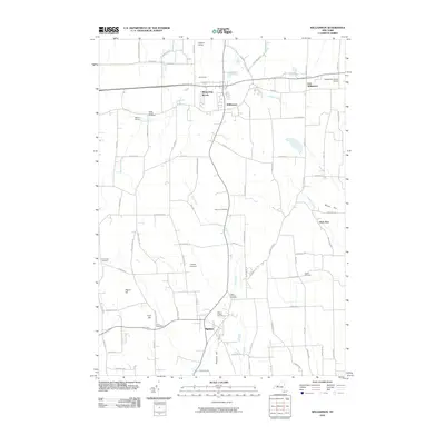
2010 Map of Williamson
USGS Topo · Published 2010About this map
Marion and Williamson anchor this survey of Wayne County, showing a landscape defined by agricultural heritage and a network of rural settlements. The terrain is marked by distinct elevations such as Prospect Hill and Beam Hill, while the drainage system of Salmon Creek and Red Creek weaves through the lowlands. The presence of numerous specialized agricultural sites like Lagoner Farms, Mason Farms, and CC Farms indicates the enduring importance of orchards and nurseries in this part of upstate New York.
Find a feature on this map
84 named features on this map. Tap any name to fly to it.
Don’t see what you’re looking for? This feature index may not catch every label — zoom into the map to look around manually.
Map Details
Editions of this 2010 Williamson Map
This is the sole edition of this map. No revisions or reprints were ever made.
Other maps of this area

1899 · Palmyra
USGS Topo · 1:62,500

1900 · Macedon
USGS Topo · 1:62,500

1902 · Pultneyville
USGS Topo · 1:62,500

1902 · Palmyra
USGS Topo · 1:62,500

1942 · Ontario
USGS Topo · 1:31,680

1942 · Pultneyville
USGS Topo · 1:31,680

1943 · Williamson
USGS Topo · 1:31,680

1943 · Sodus
USGS Topo · 1:31,680
1943 · Newark
USGS Topo · 1:31,680
1943 · Palmyra
USGS Topo · 1:31,680