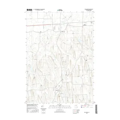
2016 Map of Williamson
USGS Topo · Published 2016About this map
Williamson and Marion anchor this landscape in Wayne County, where the topography is defined by distinctive north-south glacial drumlins. These elongated ridges, such as Pigeon Hill and Prospect Hill, dictate the local road network, forcing routes like Van Cruyningham Rd and Eddy Ridge Rd to follow the low ground between elevations. The area’s cemetery record is particularly dense, offering significant genealogical value through sites like Marion Village Cem, Ridge Chapel Cem, and the remote Gilbert Cem. Waterways including Salmon Cr and Mink Cr thread through the valleys, supporting a rural economy that includes aviation facilities like the Williamson-Sodus Airport and the smaller Ag-Alley Airport. This survey provides a clear look at the intersection of early settlement patterns and the specialized glacial geology of the Lake Ontario plains.
Find a feature on this map
77 named features on this map. Tap any name to fly to it.
Don’t see what you’re looking for? This feature index may not catch every label — zoom into the map to look around manually.
Map Details
Editions of this 2016 Williamson Map
This is the sole edition of this map. No revisions or reprints were ever made.
Other maps of this area

1899 · Palmyra
USGS Topo · 1:62,500

1900 · Macedon
USGS Topo · 1:62,500

1902 · Pultneyville
USGS Topo · 1:62,500

1902 · Palmyra
USGS Topo · 1:62,500

1942 · Ontario
USGS Topo · 1:31,680

1942 · Pultneyville
USGS Topo · 1:31,680

1943 · Williamson
USGS Topo · 1:31,680

1943 · Sodus
USGS Topo · 1:31,680
1943 · Newark
USGS Topo · 1:31,680
1943 · Palmyra
USGS Topo · 1:31,680