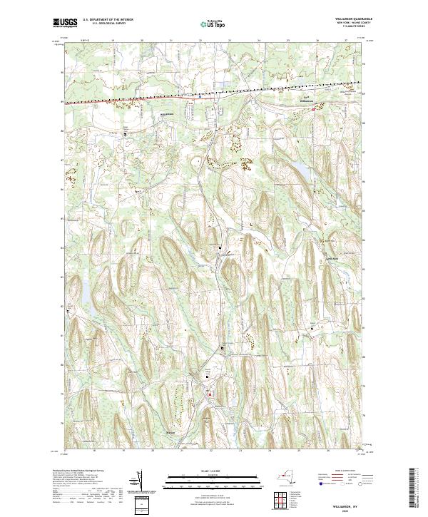
2023 Map of Williamson
USGS Topo · Published 2023About this map
Glacial drumlins and agricultural corridors define the landscape of Wayne County, centered on the primary settlements of Williamson and Marion. The terrain is characterized by north-south oriented ridges, including Pigeon Hill and Prospect Hill, which influence the drainage patterns of Salmon Creek and Red Creek as they flow toward Lake Ontario. This modern-era survey captures the dense network of rural roads that connect local hamlets like East Williamson and Owls Nest, revealing a long-established pattern of land division that remains evident even as suburban development reaches out from the village centers.
Find a feature on this map
103 named features on this map. Tap any name to fly to it.
Don’t see what you’re looking for? This feature index may not catch every label — zoom into the map to look around manually.
Map Details
Editions of this 2023 Williamson Map
This is the sole edition of this map. No revisions or reprints were ever made.
Other maps of this area

1899 · Palmyra
USGS Topo · 1:62,500

1900 · Macedon
USGS Topo · 1:62,500

1902 · Pultneyville
USGS Topo · 1:62,500

1902 · Palmyra
USGS Topo · 1:62,500

1942 · Ontario
USGS Topo · 1:31,680

1942 · Pultneyville
USGS Topo · 1:31,680

1943 · Williamson
USGS Topo · 1:31,680

1943 · Sodus
USGS Topo · 1:31,680
1943 · Newark
USGS Topo · 1:31,680
1943 · Palmyra
USGS Topo · 1:31,680