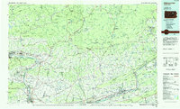
1984 Map of Williamsport East
USGS Topo · Published 1985About this map
The West Branch Susquehanna River defines the western valley of this landscape, where the urban centers of Williamsport and South Williamsport sit at the foot of Bald Eagle Mountain. By the mid-1980s, this region shows a complex intersection of industrial transport and institutional land use, with Conrail lines tracking the riverbanks and the State Correctional Institution at Muncy established near the river's bend. To the east, the terrain rises sharply into Allegheny Ridge and North Mountain, where large tracts of the Tiadaghton State Forest and State Game Lands No 13 dominate the highlands.
Find a feature on this map
287 named features on this map. Tap any name to fly to it.
Don’t see what you’re looking for? This feature index may not catch every label — zoom into the map to look around manually.
Map Details
Editions of this 1984 Williamsport East Map
2 editions found
Other maps of this area

1889 · Catawissa
USGS Topo · 1:62,500

1889 · Hazleton
USGS Topo · 1:62,500

1891 · Wilkesbarre
USGS Topo · 1:62,500

1891 · Hazleton
USGS Topo · 1:62,500

1891 · Harveys Lake
USGS Topo · 1:62,500

1892 · Catawissa
USGS Topo · 1:62,500

1892 · Shamokin
USGS Topo · 1:62,500

1892 · Mahanoy
USGS Topo · 1:62,500

1893 · Hazleton
USGS Topo · 1:62,500

1893 · Sunbury
USGS Topo · 1:62,500