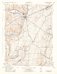
1944 Map of Williamsport
USGS Topo · Published 1944About this map
The Potomac River winds through this mid-1940s survey, serving as the definitive border between Maryland and West Virginia. The landscape is dominated by the complex transportation infrastructure around Williamsport, where the Chesapeake and Ohio Canal runs parallel to the river. Significant industrial and agricultural activity is evident through the presence of the Cushwa Brick Co and the Cedar Grove Mill.
Find a feature on this map
46 named features on this map. Tap any name to fly to it.
Don’t see what you’re looking for? This feature index may not catch every label — zoom into the map to look around manually.
Map Details
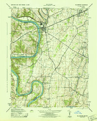
Editions of this 1944 Williamsport Map
2 editions found
Other maps of this area

1884 · Harpers Ferry
USGS Topo · 1:125,000

1891 · Harpers Ferry
USGS Topo · 1:125,000

1893 · Harpers Ferry
USGS Topo · 1:125,000

1908 · Middletown
USGS Topo · 1:48,000

1909 · Hagerstown
USGS Topo · 1:48,000

1910 · Antietam
USGS Topo · 1:62,500

1912 · Hagerstown
USGS Topo · 1:62,500

1912 · Williamsport
USGS Topo · 1:62,500

1914 · Martinsburg
USGS Topo · 1:48,000

1916 · Martinsburg
USGS Topo · 1:62,500