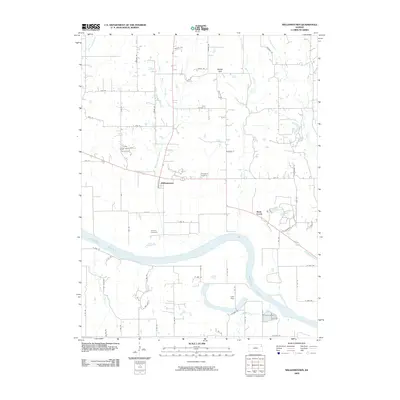
2009 Map of Williamstown
USGS Topo · Published 2009About this map
Williamstown sits as a central hub north of the winding Kansas River in this 2009 survey of Douglas County. The landscape is defined by the convergence of several waterways, including Buck Creek, Stone Horse Creek, and Mud Creek, which drain the agricultural lands between elevated points like Nolan Hill. Local history is anchored by the presence of the Holliday Cemetery and Underwood Cemetery, providing essential data for genealogical research in this rural corridor. South of the river, the settlement of Lake View and the banks of Baldwin Creek mark the transition into the outskirts of Lawrence. The map documents an intricate network of rural routes, such as Nemaha Rd and Childers Wagon Wheel Rd, reflecting a landscape that maintains its rural character while being influenced by the proximity of larger neighboring communities.
Find a feature on this map
59 named features on this map. Tap any name to fly to it.
Don’t see what you’re looking for? This feature index may not catch every label — zoom into the map to look around manually.
Map Details
Editions of this 2009 Williamstown Map
This is the sole edition of this map. No revisions or reprints were ever made.
Other maps of this area

1885 · Lawrence
USGS Topo · 1:125,000

1886 · Oskaloosa
USGS Topo · 1:125,000

1888 · Oskaloosa
USGS Topo · 1:125,000

1889 · Lawrence
USGS Topo · 1:125,000

1894 · Oskaloosa
USGS Topo · 1:125,000

1947 · Lawrence
USGS Topo · 1:250,000

1949 · Williamstown
USGS Topo · 1:24,000

1949 · Perry
USGS Topo · 1:24,000

1950 · Perry
USGS Topo · 1:24,000

1950 · Kansas City
USGS Topo · 1:250,000