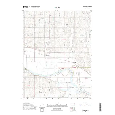
2018 Map of Williamstown
USGS Topo · Published 2018About this map
The Kansas River carves a broad valley through the borderlands of Jefferson and Douglas Counties, defining the agricultural and transit corridor that supports settlements like Williamstown and Perry. In this part of the Kaw Valley, the landscape transitions from the flat alluvial plains near the river to the higher elevations of Nolan Hill. Local history is preserved in small rural burial grounds such as Underwood Cem and Holliday Cem, which sit alongside a grid of section roads that have guided land use for over a century. North of the river, Stonehenge Airport provides a small aviation footprint amidst the drainage systems of Buck Cr and Plum Cr. The map captures the northern outskirts of Lawrence, where the terrain begins to rise away from the floodplain, illustrating the geographic divide between the urban reach of the university city and the enduring rural character of the river valley townships.
Find a feature on this map
73 named features on this map. Tap any name to fly to it.
Don’t see what you’re looking for? This feature index may not catch every label — zoom into the map to look around manually.
Map Details
Editions of this 2018 Williamstown Map
This is the sole edition of this map. No revisions or reprints were ever made.
Other maps of this area

1885 · Lawrence
USGS Topo · 1:125,000

1886 · Oskaloosa
USGS Topo · 1:125,000

1888 · Oskaloosa
USGS Topo · 1:125,000

1889 · Lawrence
USGS Topo · 1:125,000

1894 · Oskaloosa
USGS Topo · 1:125,000

1947 · Lawrence
USGS Topo · 1:250,000

1949 · Williamstown
USGS Topo · 1:24,000

1949 · Perry
USGS Topo · 1:24,000

1950 · Perry
USGS Topo · 1:24,000

1950 · Kansas City
USGS Topo · 1:250,000