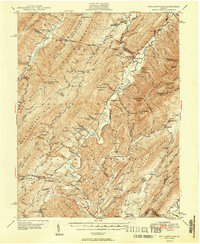
1949 Map of Williamsville
USGS Topo · Published 1949About this map
George Washington National Forest covers the majority of this landscape, where the ridges of Jack Mountain and Warm Springs Mtn create a corrugated terrain of steep drafts and narrow valleys. This late-1940s survey reveals a network of dispersed rural communities and spiritual centers, such as Stony Run Ch, Starr Chapel, and Valley Bethel Ch. The settlement pattern follows the drainage of the Bullpasture River and Cowpasture River, with small hubs like Williamsville and Burnsville serving as local anchors.
Find a feature on this map
138 named features on this map. Tap any name to fly to it.
Don’t see what you’re looking for? This feature index may not catch every label — zoom into the map to look around manually.
Map Details
Editions of this 1949 Williamsville Map
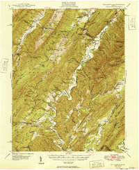
2 editions found
Other maps of this area

1894 · Staunton
USGS Topo · 1:125,000

1894 · Natural Bridge
USGS Topo · 1:125,000

1894 · Lexington
USGS Topo · 1:125,000

1901 · Monterey
USGS Topo · 1:125,000

1922 · Cass
USGS Topo · 1:48,000

1923 · Warm Springs
USGS Topo · 1:48,000

1924 · Cass
USGS Topo · 1:62,500

1924 · Mc Dowell
USGS Topo · 1:62,500

1926 · Warm Springs
USGS Topo · 1:62,500

1930 · Warm Springs Run
USGS Topo · 1:24,000