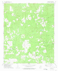
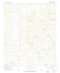
1973 Map of Willisville
USGS Topo · Published 1975About this map
The Irma Oil Field and Willisville Oil Field dominate the landscape of Nevada County in the early 1970s, illustrating the heavy industrial footprint of petroleum extraction in southern Arkansas. The map centers on the small communities of Willisville and Rosston, connected by a network of rural routes including the Old Military Road and Mc Neil Road. This survey reveals a complex mix of economic activity, where traditional agricultural features like the fish farm near Cypress Creek exist alongside modern energy infrastructure.
Find a feature on this map
32 named features on this map. Tap any name to fly to it.
Don’t see what you’re looking for? This feature index may not catch every label — zoom into the map to look around manually.
Map Details
Editions of this 1973 Willisville Map
This is the sole edition of this map. No revisions or reprints were ever made.
Other maps of this area

1901 · Gurdon
USGS Topo · 1:125,000

1953 · El Dorado
USGS Topo · 1:250,000

1957 · El Dorado
USGS Topo · 1:250,000

1958 · El Dorado
USGS Topo · 1:250,000

1960 · El Dorado
USGS Topo · 1:250,000

1968 · Lamartine
USGS Topo · 1:24,000
1968 · Falcon
USGS Topo · 1:24,000
1969 · Magnolia NW
USGS Topo · 1:24,000
1973 · Bodcaw
USGS Topo · 1:24,000
1973 · Bluff City
USGS Topo · 1:24,000