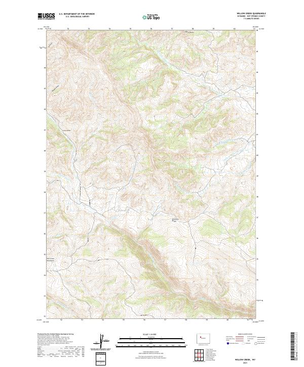
2021 Map of Willow Creek
USGS Topo · Published 2021About this map
Absaroka Range and the Owl Creek Mountains converge in this high-elevation landscape of Hot Springs County, where a complex network of seasonal and perennial drainages carves through the terrain. The hydrological pattern is defined by the headwaters of the S Fork Owl Cr and its numerous tributaries, including Curry Cr and Cherry Cr, which dictate the natural travel corridors through the mountains.
Find a feature on this map
24 named features on this map. Tap any name to fly to it.
Don’t see what you’re looking for? This feature index may not catch every label — zoom into the map to look around manually.
Map Details
Editions of this 2021 Willow Creek Map
This is the sole edition of this map. No revisions or reprints were ever made.
Other maps of this area

1904 · Kirwin
USGS Topo · 1:125,000

1906 · Kirwin
USGS Topo · 1:125,000

1952 · Antelope Ridge
USGS Topo · 1:24,000

1955 · Thermopolis
USGS Topo · 1:250,000

1956 · Milk Creek
USGS Topo · 1:24,000

1958 · Thermopolis
USGS Topo · 1:250,000

1962 · Thermopolis
USGS Topo · 1:250,000
1965 · Eagle Nest Ranch
USGS Topo · 1:24,000

1967 · Willow Creek
USGS Topo · 1:24,000
1967 · Circle Ridge
USGS Topo · 1:24,000