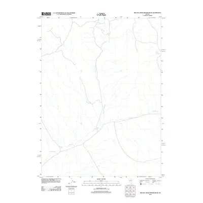
2012 Map of Willow Creek Reservoir SE
USGS Topo · Published 2012About this map
North Antelope Creek defines the drainage of this arid high-desert landscape in Elko County. The map details a remote region of northeastern Nevada, illustrating the complex network of intermittent watercourses and draws that shape the terrain. Antelope Creek joins the northern fork near the center of the sheet, while Antelope Draw marks the western approach. A small water source at Mud Spring provides a rare landmark in the eastern section. This 2012 survey illustrates the sparse infrastructure of the Great Basin, focusing on the natural hydrography that has governed land use and ranching boundaries in this part of the state for generations.
Find a feature on this map
4 named features on this map. Tap any name to fly to it.
Don’t see what you’re looking for? This feature index may not catch every label — zoom into the map to look around manually.
Map Details
Editions of this 2012 Willow Creek Reservoir SE Map
This is the sole edition of this map. No revisions or reprints were ever made.
Other maps of this area

1955 · McDermitt
USGS Topo · 1:250,000

1955 · Winnemucca
USGS Topo · 1:250,000

1958 · Winnemucca
USGS Topo · 1:250,000

1959 · McDermitt
USGS Topo · 1:250,000

1962 · Winnemucca
USGS Topo · 1:250,000

1965 · Willow Creek Reservoir
USGS Topo · 1:24,000

1965 · Sheep Creek Range NE
USGS Topo · 1:24,000

1965 · Sheep Creek Range NW
USGS Topo · 1:24,000

1965 · Squaw Valley Ranch
USGS Topo · 1:24,000

1965 · Rock Creek Ranch
USGS Topo · 1:24,000