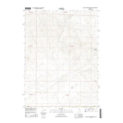
2014 Map of Willow Creek Reservoir SE
USGS Topo · Published 2014About this map
The Santa Renia Mountains and the Sheep Creek Range converge in this high-desert corner of Elko County. This landscape is defined by the complex drainage patterns of Antelope Cr and the N Antelope Cr, which carve through the arid terrain of north-central Nevada. Beyond the primary watercourses, subtle landmarks like Mud Spring and the topographical recession of Antelope Draw reveal the scarce but critical water sources that have historically sustained life and movement in this isolated region. The map illustrates a transitional zone where these two prominent ranges meet, capturing the area before modern development altered its primitive character.
Find a feature on this map
7 named features on this map. Tap any name to fly to it.
Don’t see what you’re looking for? This feature index may not catch every label — zoom into the map to look around manually.
Map Details
Editions of this 2014 Willow Creek Reservoir SE Map
This is the sole edition of this map. No revisions or reprints were ever made.
Other maps of this area

1955 · McDermitt
USGS Topo · 1:250,000

1955 · Winnemucca
USGS Topo · 1:250,000

1958 · Winnemucca
USGS Topo · 1:250,000

1959 · McDermitt
USGS Topo · 1:250,000

1962 · Winnemucca
USGS Topo · 1:250,000

1965 · Willow Creek Reservoir
USGS Topo · 1:24,000

1965 · Sheep Creek Range NE
USGS Topo · 1:24,000

1965 · Sheep Creek Range NW
USGS Topo · 1:24,000

1965 · Squaw Valley Ranch
USGS Topo · 1:24,000

1965 · Rock Creek Ranch
USGS Topo · 1:24,000