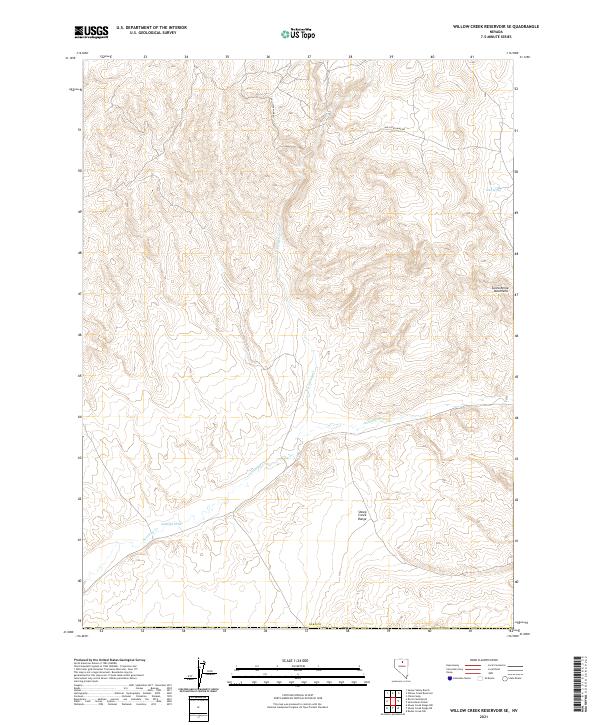
2021 Map of Willow Creek Reservoir SE
USGS Topo · Published 2021About this map
The Santa Renia Mountains and the Sheep Creek Range dominate this high-desert landscape in northern Elko County. The drainage pattern is defined by the east-west course of Antelope Cr and its tributaries, including N Antelope Cr and Antelope Draw. This 2021 survey illustrates a sparsely populated region primarily utilized for ranching and resource extraction, with the Hollister Mine Rd cutting through the northern townships. Water sources are critical in this arid environment, marked by features such as Mud Spring on the eastern edge of the quadrangle. The map detail reflects the persistence of cattle-range operations in the Great Basin, where isolated springs and seasonal creek beds remain the primary landmarks for navigation and land management.
Find a feature on this map
16 named features on this map. Tap any name to fly to it.
Don’t see what you’re looking for? This feature index may not catch every label — zoom into the map to look around manually.
Map Details
Editions of this 2021 Willow Creek Reservoir SE Map
This is the sole edition of this map. No revisions or reprints were ever made.
Other maps of this area

1955 · McDermitt
USGS Topo · 1:250,000

1955 · Winnemucca
USGS Topo · 1:250,000

1958 · Winnemucca
USGS Topo · 1:250,000

1959 · McDermitt
USGS Topo · 1:250,000

1962 · Winnemucca
USGS Topo · 1:250,000

1965 · Willow Creek Reservoir
USGS Topo · 1:24,000

1965 · Sheep Creek Range NE
USGS Topo · 1:24,000

1965 · Sheep Creek Range NW
USGS Topo · 1:24,000

1965 · Squaw Valley Ranch
USGS Topo · 1:24,000

1965 · Rock Creek Ranch
USGS Topo · 1:24,000