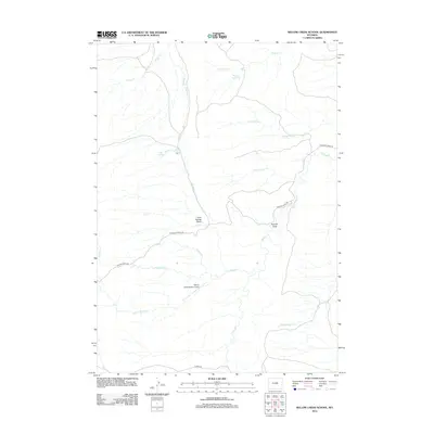
2012 Map of Willow Creek School
USGS Topo · Published 2012About this map
The high plains of Natrona County are defined by a complex network of seasonal drainages and ranch infrastructure as they appeared in 2012. Willow Creek Ranch Airport stands as a primary landmark in this expansive landscape, situated near the confluence of several key waterways including Big Willow Cr and Ranch Cr. The map details the subtle relief of the area through features like Cow Spring Gulch and Holman Draw, which steer the flow of water during the wet seasons toward larger systems like Willow Cr.
Find a feature on this map
20 named features on this map. Tap any name to fly to it.
Don’t see what you’re looking for? This feature index may not catch every label — zoom into the map to look around manually.
Map Details
Editions of this 2012 Willow Creek School Map
This is the sole edition of this map. No revisions or reprints were ever made.
Other maps of this area

1955 · Arminto
USGS Topo · 1:250,000

1958 · Arminto
USGS Topo · 1:250,000

1961 · Barnum
USGS Topo · 1:62,500

1961 · TTT Ranch
USGS Topo · 1:24,000

1962 · Arminto
USGS Topo · 1:250,000

1968 · Willow Creek School
USGS Topo · 1:24,000

1968 · Roughlock Hill
USGS Topo · 1:24,000

1968 · Big Sulfur Draw
USGS Topo · 1:24,000

1968 · Fiftymile Flat
USGS Topo · 1:24,000

1968 · Flat Top Hill
USGS Topo · 1:24,000