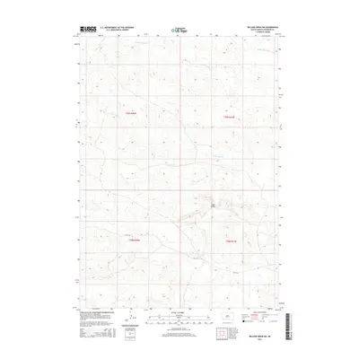
2015 Map of Willow Creek SW
USGS Topo · Published 2015About this map
Cedar Bluffs rises as the primary landmark in this section of Oglala Lakota County, overlooking a landscape defined by the intermittent drainage of the Willow Creek system. The map documents the persistent path of Old US-18, a former arterial route that snakes through the southern half of the quadrangle, serving as a corridor through the high plains. Water features are concentrated in the north and east, where the W Fork Willow Cr and Middle Fork Willow Cr begin their descent. This 2015 survey provides a modern topographical look at the land within the boundaries of t39n r48w and t38n r47w, showing the enduring rural road patterns and the natural erosion features typical of this part of South Dakota, notably around Cedar Bluff Cr.
Find a feature on this map
9 named features on this map. Tap any name to fly to it.
Don’t see what you’re looking for? This feature index may not catch every label — zoom into the map to look around manually.
Map Details
Editions of this 2015 Willow Creek SW Map
This is the sole edition of this map. No revisions or reprints were ever made.
Other maps of this area

1896 · Oelrichs
USGS Topo · 1:125,000

1900 · Oelrichs
USGS Topo · 1:125,000

1951 · Willow Creek NW
USGS Topo · 1:24,000

1951 · Willow Creek NE
USGS Topo · 1:24,000

1951 · Smithwick NE
USGS Topo · 1:24,000

1955 · Hot Springs
USGS Topo · 1:250,000

1967 · Slim Butte NW
USGS Topo · 1:24,000

1967 · Slim Butte NE
USGS Topo · 1:24,000

1967 · Willow Creek SW
USGS Topo · 1:24,000

1967 · Willow Creek
USGS Topo · 1:24,000