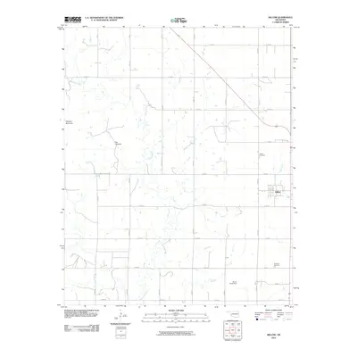
2010 Map of Willow
USGS Topo · Published 2010About this map
The town of Willow serves as the focal point for this Southwest Oklahoma landscape, where the flat plains of Greer County are interrupted by the distinct elevations of Haystack Mountain and the geological feature known as The Haystack. The map documents a predominantly rural infrastructure defined by a rigid grid of county roads, such as N 1940 Rd and E 1350 Rd, that supports the agricultural economy of the region. Local history and genealogy are preserved through markers like the Willow Cemetery and Brinkman Cemetery, while water management is evidenced by the James Travis Dam on a tributary of Haystack Creek. The presence of Lake Creek further defines the drainage patterns that have shaped the settlement and land use of this area since the early twentieth century.
Find a feature on this map
24 named features on this map. Tap any name to fly to it.
Don’t see what you’re looking for? This feature index may not catch every label — zoom into the map to look around manually.
Map Details
Editions of this 2010 Willow Map
This is the sole edition of this map. No revisions or reprints were ever made.
Other maps of this area

1955 · Lawton
USGS Topo · 1:250,000

1955 · Clinton
USGS Topo · 1:250,000

1957 · Clinton
USGS Topo · 1:250,000

1961 · Willow
USGS Topo · 1:62,500

1961 · Retrop
USGS Topo · 1:62,500

1971 · Mangum North
USGS Topo · 1:24,000

1971 · Granite
USGS Topo · 1:24,000

1971 · Reed
USGS Topo · 1:24,000

1985 · Elk City
USGS Topo · 1:100,000

1985 · Altus
USGS Topo · 1:100,000