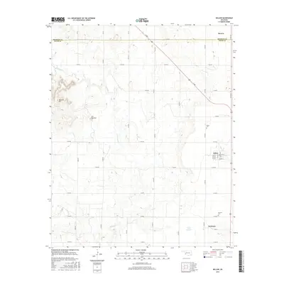
2016 Map of Willow
USGS Topo · Published 2016About this map
The town of Willow serves as the central hub of this Greer County landscape, where the flat, grid-based agricultural plains meet distinctive geological features. To the west, the terrain is interrupted by the elevations of Haystack Mtn and a formation simply labeled The Haystack, both of which rise above the surrounding drainages of Haystack Cr. This area illustrates the late twentieth-century development of water management in Western Oklahoma, notably seen at the James Travis Reservoir. The map captures a transition in settlement patterns, from the organized streets of Willow, featuring Mayer Ave and Stepp Ave, to smaller outlying communities like Brinkman and Moravia near the Beckham County line. Local heritage is anchored by sites such as the Willow Cem and Brinkman Cem, which remain as permanent markers of the families who settled this prairie.
Find a feature on this map
37 named features on this map. Tap any name to fly to it.
Don’t see what you’re looking for? This feature index may not catch every label — zoom into the map to look around manually.
Map Details
Editions of this 2016 Willow Map
This is the sole edition of this map. No revisions or reprints were ever made.
Other maps of this area

1955 · Lawton
USGS Topo · 1:250,000

1955 · Clinton
USGS Topo · 1:250,000

1957 · Clinton
USGS Topo · 1:250,000

1961 · Willow
USGS Topo · 1:62,500

1961 · Retrop
USGS Topo · 1:62,500

1971 · Mangum North
USGS Topo · 1:24,000

1971 · Granite
USGS Topo · 1:24,000

1971 · Reed
USGS Topo · 1:24,000

1985 · Elk City
USGS Topo · 1:100,000

1985 · Altus
USGS Topo · 1:100,000