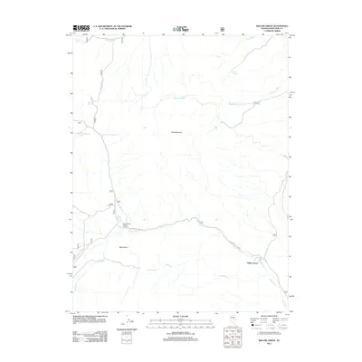
2012 Map of Willow Grove
USGS Topo · Published 2012About this map
Willow Grove sits at the base of the high desert terrain in this White Pine County landscape, where the drainage of Ellison Cr meets the southern reaches of the valley. The map reveals a land defined by its water sources, essential for both ranching and forest management, including the Ellison Forest Service Facility and a series of high-altitude water points such as Little Tom Plain Spring and Easter Springs. Significant landmarks like Bald Mountain and Black Butte dominate the central topography, providing fixed points for navigation in a region primarily accessed via Stone Spring Rd and White Pine Co Road 10. The presence of the Deadman Reservoir and its associated Deadman Wash illustrate the historical and ongoing efforts to manage seasonal runoff in this arid environment.
Find a feature on this map
19 named features on this map. Tap any name to fly to it.
Don’t see what you’re looking for? This feature index may not catch every label — zoom into the map to look around manually.
Map Details
Editions of this 2012 Willow Grove Map
This is the sole edition of this map. No revisions or reprints were ever made.
Other maps of this area

1949 · Treasure Hill
USGS Topo · 1:62,500

1950 · Treasure Hill
USGS Topo · 1:62,500

1956 · Lund
USGS Topo · 1:250,000

1956 · Ely
USGS Topo · 1:250,000

1957 · Currant Mtn
USGS Topo · 1:62,500

1959 · Ely
USGS Topo · 1:250,000

1959 · Preston Reservoir
USGS Topo · 1:62,500

1960 · Lund
USGS Topo · 1:250,000

1963 · Ely
USGS Topo · 1:250,000

1964 · Currant Mtn
USGS Topo · 1:62,500