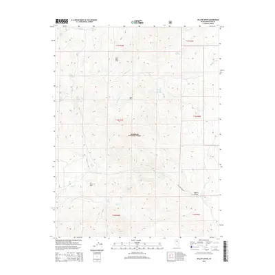
2014 Map of Willow Grove
USGS Topo · Published 2014About this map
The White Pine Range dominates this landscape within the Humboldt National Forest, where high desert terrain meets a complex system of seasonal washes and isolated springs. The settlement of Willow Grove sits at the base of these mountains, serving as a focal point along White Pine Co Road 10. The topography is defined by prominent peaks like Bald Mtn and Black Butte, which overlook a network of hydrologic features essential to the region's ranching and wilderness history. Water sources such as Mustang Spring Reservoir and Indian Springs provide critical points of interest for those tracing land use in this arid portion of Nevada. The drainage patterns of Ellison Cr and Copper Cr further illustrate the rugged geography that has shaped local movement and settlement patterns since the nineteenth century.
Find a feature on this map
26 named features on this map. Tap any name to fly to it.
Don’t see what you’re looking for? This feature index may not catch every label — zoom into the map to look around manually.
Map Details
Editions of this 2014 Willow Grove Map
This is the sole edition of this map. No revisions or reprints were ever made.
Other maps of this area

1949 · Treasure Hill
USGS Topo · 1:62,500

1950 · Treasure Hill
USGS Topo · 1:62,500

1956 · Lund
USGS Topo · 1:250,000

1956 · Ely
USGS Topo · 1:250,000

1957 · Currant Mtn
USGS Topo · 1:62,500

1959 · Ely
USGS Topo · 1:250,000

1959 · Preston Reservoir
USGS Topo · 1:62,500

1960 · Lund
USGS Topo · 1:250,000

1963 · Ely
USGS Topo · 1:250,000

1964 · Currant Mtn
USGS Topo · 1:62,500