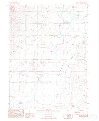
1988 Map of Willow Point
USGS Topo · Published 1989About this map
Paradise Valley dominates this 1980s landscape, where the confluence of desert hydrology and rural infrastructure is clearly defined. The Little Humboldt River meanders through the eastern portion of the sheet, while Big Cottonwood Creek and Martin Creek provide drainage across the northern and central basins. This area near Willow Point reflects a specialized ranching and transportation environment, marked by the presence of a remote Landing Strip and a series of Levee systems and ditches designed to manage water flow. Numerous Alkali Flat labels indicate the arid nature of the basin floor between the peaks. The infrastructure of the era is represented by a long Pipeline crossing the terrain and scattered Borrow Pits, showing the ongoing maintenance and resource extraction within Humboldt County during the late twentieth century.
Find a feature on this map
15 named features on this map. Tap any name to fly to it.
Don’t see what you’re looking for? This feature index may not catch every label — zoom into the map to look around manually.
Map Details
Editions of this 1988 Willow Point Map
This is the sole edition of this map. No revisions or reprints were ever made.
Other maps of this area

1882 · Paradise
USGS Topo · 1:250,000

1893 · Paradise
USGS Topo · 1:250,000

1945 · Osgood Mountains
USGS Topo · 1:62,500

1945 · Hot Springs
USGS Topo · 1:62,500

1947 · Osgood Mountains
USGS Topo · 1:62,500

1947 · Hot Springs Peak
USGS Topo · 1:62,500

1955 · McDermitt
USGS Topo · 1:250,000

1958 · Paradise Valley
USGS Topo · 1:62,500

1959 · McDermitt
USGS Topo · 1:250,000

1959 · Bliss
USGS Topo · 1:62,500