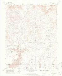
1965 Map of Willow Spring
USGS Topo · Published 1967About this map
San Juan National Forest defines this mid-1960s landscape, characterized by a complex network of upland plateaus and deep drainage canyons. The topography is dotted with numerous small water management features, including Willow Spring Reservoir, Pot Hole Reservoir, and East Lake Reservoir, reflecting the historical focus on livestock and land management in this part of Dolores and Montezuma counties.
Find a feature on this map
38 named features on this map. Tap any name to fly to it.
Don’t see what you’re looking for? This feature index may not catch every label — zoom into the map to look around manually.
Map Details
Editions of this 1965 Willow Spring Map
2 editions found
Other maps of this area

1956 · Cortez
USGS Topo · 1:250,000

1958 · Cortez
USGS Topo · 1:250,000

1959 · Cortez
USGS Topo · 1:250,000

1962 · Cortez
USGS Topo · 1:250,000

1963 · Stoner
USGS Topo · 1:24,000
1963 · Nipple Mountain
USGS Topo · 1:24,000
1964 · Groundhog Reservoir
USGS Topo · 1:24,000

1964 · Glade Mountain
USGS Topo · 1:24,000
1964 · South Mountain
USGS Topo · 1:24,000

1965 · Willow Spring
USGS Topo · 1:24,000