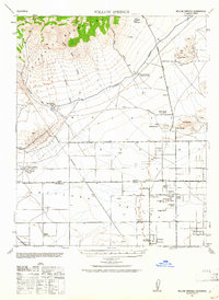
1943 Map of Willow Springs
USGS Topo · Published 1961About this map
The Tehachapi Mountains dominate the northern landscape of this 1943 survey, giving way to the broad alluvial Bajada and the arid flats of the Antelope Valley. This era of California history is marked by the critical infrastructure of water and power, visible in the sprawling Los Angeles Aqueduct and the Edison Co Transmission Line cutting across the desert floor. In the lower reaches, a network of isolated homesteads and family-named landmarks such as Wagon Wheel Ranch and Rottman Ranch illustrates the livestock-driven economy of the Mojave borderlands.
Find a feature on this map
33 named features on this map. Tap any name to fly to it.
Don’t see what you’re looking for? This feature index may not catch every label — zoom into the map to look around manually.
Map Details
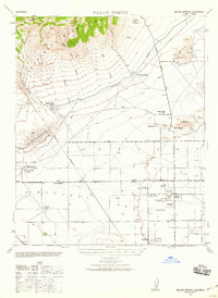
Editions of this 1943 Willow Springs Map
3 editions found

Other maps of this area

1903 · Tejon
USGS Topo · 1:125,000

1914 · Caliente
USGS Topo · 1:125,000

1915 · Elizabeth Lake
USGS Topo · 1:125,000

1915 · Mojave
USGS Topo · 1:125,000

1917 · Elizabeth Lake
USGS Topo · 1:125,000

1931 · Little Buttes
USGS Topo · 1:24,000

1931 · Esperanza School
USGS Topo · 1:24,000

1932 · Fairmont
USGS Topo · 1:24,000

1933 · Manzana
USGS Topo · 1:24,000

1934 · Little Buttes
USGS Topo · 1:24,000