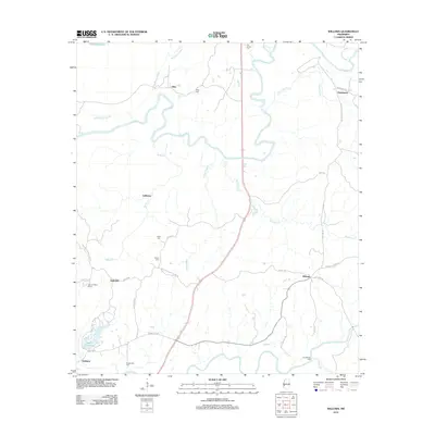
2012 Map of Willows
USGS Topo · Published 2012About this map
Big Black River meanders across this landscape, forming the centerpiece of a region defined by its watercourses and rural settlements. In this 2012 snapshot, small communities like Allen, Hankinson, and Willows are connected by a network of local roads including Old Port Gibson Rd and Willows Rd. The land is dotted with several family and community burial grounds, such as Old Savoy Cem, Allen Cem, and Shiloh Cem, which offer significant value for genealogical research. To the south, Bayou Pierre and its tributary Whisky Br pass through Grindstone Ford, a name reflecting the historical river crossings of the area. The presence of Warner YMCA Camp near Lake Claiborne and Ingleside indicates the area's mix of recreational land use and traditional agricultural or residential holdings. The complex drainage patterns of Gunns Bayou, Drakes Bayou, and Kennison Cr illustrate the swampy bottomland character that has long shaped life in this part of Mississippi.
Find a feature on this map
43 named features on this map. Tap any name to fly to it.
Don’t see what you’re looking for? This feature index may not catch every label — zoom into the map to look around manually.
Map Details
Editions of this 2012 Willows Map
This is the sole edition of this map. No revisions or reprints were ever made.
Other maps of this area

1939 · Yokena
USGS Topo · 1:62,500

1939 · Lorman
USGS Topo · 1:62,500

1953 · Natchez
USGS Topo · 1:250,000

1955 · Jackson
USGS Topo · 1:250,000

1956 · Natchez
USGS Topo · 1:250,000

1958 · St. Joseph
USGS Topo · 1:62,500

1959 · Natchez
USGS Topo · 1:250,000

1961 · Jackson
USGS Topo · 1:250,000

1962 · Jackson
USGS Topo · 1:250,000

1963 · Carlisle
USGS Topo · 1:24,000