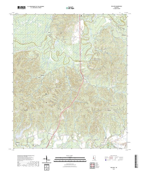
2024 Map of Willows
USGS Topo · Published 2024About this map
The Big Black River meanders along the northern boundary of this Claiborne County landscape, defining the border with Warren County. The terrain transitions from the low-lying wetlands of Little Bogue Desha and Blackman Bayou into the distinctively named Scutchillo Hills. This modern survey documents the rural character of the region, where historical crossing points like Hankinsons Ferry and small settlements such as Allen and Willows anchor the local geography.
Find a feature on this map
44 named features on this map. Tap any name to fly to it.
Don’t see what you’re looking for? This feature index may not catch every label — zoom into the map to look around manually.
Map Details
Editions of this 2024 Willows Map
This is the sole edition of this map. No revisions or reprints were ever made.
Other maps of this area

1939 · Yokena
USGS Topo · 1:62,500

1939 · Lorman
USGS Topo · 1:62,500

1953 · Natchez
USGS Topo · 1:250,000

1955 · Jackson
USGS Topo · 1:250,000

1956 · Natchez
USGS Topo · 1:250,000

1958 · St. Joseph
USGS Topo · 1:62,500

1959 · Natchez
USGS Topo · 1:250,000

1961 · Jackson
USGS Topo · 1:250,000

1962 · Jackson
USGS Topo · 1:250,000

1963 · Carlisle
USGS Topo · 1:24,000