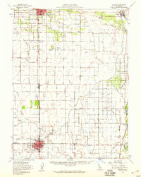
1951 Map of Willows
USGS Topo · Published 1959About this map
Agricultural development along the Sacramento River and the Southern Pacific rail line characterizes this mid-century survey of Glenn County. The landscape is defined by an intricate network of irrigation, including the Colusa Canal and numerous siphons and pumping plants that supported the local orchard economy, such as Mills Orchard. Significant rural infrastructure is visible, from the Jacinto Grange to several community schoolhouses like Kanawha Sch and Plaza Sch. The city of Willows serves as a regional hub, featuring the Willows Airport, the local Fairgrounds, and a concentrated grid of streets. Smaller settlements like Artois, Hamilton City, and Glenn are connected by well-established routes such as St John Road and Sidds Road. Aviation history is also noted with the presence of the Haigh Landing Field north of Willows.
Find a feature on this map
56 named features on this map. Tap any name to fly to it.
Don’t see what you’re looking for? This feature index may not catch every label — zoom into the map to look around manually.
Map Details
Editions of this 1951 Willows Map
This is the sole edition of this map. No revisions or reprints were ever made.
Other maps of this area

1888 · Marysville
USGS Topo · 1:125,000

1891 · Chico
USGS Topo · 1:125,000

1891 · Marysville
USGS Topo · 1:125,000

1893 · Chico
USGS Topo · 1:125,000

1894 · Marysville
USGS Topo · 1:125,000

1895 · Marysville
USGS Topo · 1:125,000

1895 · Chico
USGS Topo · 1:125,000

1904 · Vina
USGS Topo · 1:62,500

1904 · Walker Creek
USGS Topo · 1:31,680

1904 · Logan Creek
USGS Topo · 1:24,000