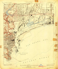
1925 Map of Wilmington
USGS Topo · Published 1925About this map
Industrial development and maritime commerce define this 1920s landscape as the Los Angeles Harbor takes shape. The infrastructure of the era is evident in the dense network of the Pacific Electric and Southern Pacific railroads serving the Union Oil Refinery and the Southern California Edison Co Power Plant. While San Pedro and Wilmington show established street grids, much of the waterfront remains a work in progress with various dredging projects including Slip No 5, the Mormon Island Channel, and the deepening Turning Basin. Military interests are firmly anchored at the Fort Mc Arthur Upper Reservation and Fort Mc Arthur Lower Res, guarding the entrance to San Pedro Bay. The map also captures the natural hydrology before extensive modification, such as the waters of Bixby Slough and the Salt Ponds near the Los Angeles River.
Find a feature on this map
44 named features on this map. Tap any name to fly to it.
Don’t see what you’re looking for? This feature index may not catch every label — zoom into the map to look around manually.
Map Details
Editions of this 1925 Wilmington Map
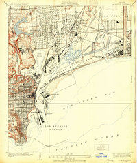
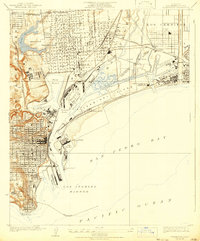
3 editions found
Other maps of this area

1896 · Redondo
USGS Topo · 1:62,500

1896 · Las Bolsas
USGS Topo · 1:62,500

1896 · San Pedro
USGS Topo · 1:62,500

1896 · Downey
USGS Topo · 1:62,500

1899 · Downey
USGS Topo · 1:62,500

1901 · Southern California Sheet No. 1
USGS Topo · 1:250,000

1902 · Downey
USGS Topo · 1:62,500

1904 · Southern California Sheet No. 1
USGS Topo · 1:250,000

1923 · Wilmington
USGS Topo · 1:24,000

1924 · Torrance
USGS Topo · 1:24,000