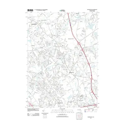
2012 Map of Wilmington
USGS Topo · Published 2012About this map
Wilmington sits at a historic convergence of transportation and water in Middlesex County, defined by the winding course of the Shawsheen River and the complex rail infrastructure of the B & M RR. The landscape is dotted with several distinct burial grounds, including the Tewksbury State Hospital Cem and Wildwood Cem, providing significant points of interest for genealogical research. Neighborhoods and smaller settlements like Pattenville, Silver Lake, and Burtts Crossing are shown in detail, illustrating the suburban infill between the major corridors of I-93 and the rail junctions. Local recreation and utility are anchored by the Silver Lake Town Beach and the Tew-Mac Airport, while numerous water bodies such as Lubbers Brook and Maple Meadow Brook highlight the area's natural drainage patterns into the Ipswich River basin.
Find a feature on this map
63 named features on this map. Tap any name to fly to it.
Don’t see what you’re looking for? This feature index may not catch every label — zoom into the map to look around manually.
Map Details
Editions of this 2012 Wilmington Map
This is the sole edition of this map. No revisions or reprints were ever made.
Other maps of this area

1886 · Lawrence
USGS Topo · 1:62,500

1886 · Lowell
USGS Topo · 1:62,500

1886 · Framingham
USGS Topo · 1:62,500

1888 · Lawrence
USGS Topo · 1:62,500

1889 · Framingham
USGS Topo · 1:62,500

1893 · Lowell
USGS Topo · 1:62,500

1893 · Boston
USGS Topo · 1:62,500

1893 · Lawrence
USGS Topo · 1:62,500

1894 · Framingham
USGS Topo · 1:62,500

1903 · Boston
USGS Topo · 1:62,500