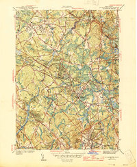
1944 Map of Wilmington
USGS Topo · Published 1944About this map
The Shawsheen River and the Boston and Maine Railroad define the industrial and natural corridors of Middlesex County during the mid-1940s. Centered on Wilmington, this survey reveals a landscape where rail infrastructure remains central to local life, evidenced by major nodes like Lowell Junction and Wilmington Junction. The northern section is dominated by the sprawling grounds of the State Infirmary and nearby Tewksbury Cem in Tewksbury, reflecting the significant institutional presence of the era.
Find a feature on this map
54 named features on this map. Tap any name to fly to it.
Don’t see what you’re looking for? This feature index may not catch every label — zoom into the map to look around manually.
Map Details
Editions of this 1944 Wilmington Map
2 editions found
Other maps of this area

1886 · Lawrence
USGS Topo · 1:62,500

1886 · Lowell
USGS Topo · 1:62,500

1886 · Framingham
USGS Topo · 1:62,500

1888 · Lawrence
USGS Topo · 1:62,500

1889 · Framingham
USGS Topo · 1:62,500

1893 · Lowell
USGS Topo · 1:62,500

1893 · Boston
USGS Topo · 1:62,500

1893 · Lawrence
USGS Topo · 1:62,500

1894 · Framingham
USGS Topo · 1:62,500

1903 · Boston
USGS Topo · 1:62,500