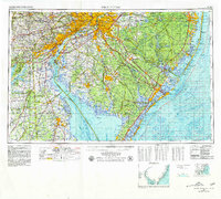
1966 Map of Wilmington
USGS Topo · Published 1979About this map
Wilmington and Philadelphia anchor a mid-century transportation corridor where the Delaware River separates the industrial centers of Pennsylvania and Delaware from the southern New Jersey coastal plain. This 1970s topographic-bathymetric revision details a landscape defined by massive infrastructure projects, including the New Jersey Turnpike and the Delaware Memorial Bridge, which facilitated the rapid post-war growth of suburbs like Cherry Hill and Lindenwold.
Find a feature on this map
349 named features on this map. Tap any name to fly to it.
Don’t see what you’re looking for? This feature index may not catch every label — zoom into the map to look around manually.
Map Details
Editions of this 1966 Wilmington Map
4 editions found
Other maps of this area

1884 · Sea Isle
USGS Topo · 1:62,500

1884 · Whitings
USGS Topo · 1:62,500

1887 · Atlantic City
USGS Topo · 1:62,500

1888 · Bordentown
USGS Topo · 1:62,500

1888 · Pemberton
USGS Topo · 1:62,500

1888 · Barnegat
USGS Topo · 1:62,500

1888 · Cape May
USGS Topo · 1:62,500

1888 · Dennisville
USGS Topo · 1:62,500

1888 · Little Egg Harbor
USGS Topo · 1:62,500

1888 · Mount Holly
USGS Topo · 1:62,500