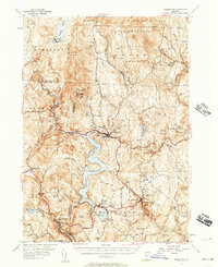
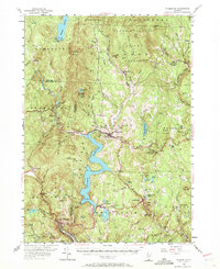
1954 Map of Wilmington
USGS Topo · Published 1957About this map
The Harriman Reservoir and Somerset Reservoir dominate this mid-century Vermont landscape, illustrating the significant role of hydroelectric power along the Deerfield River. The presence of the Hoosac Tunnel and Wilmington RR winding toward Readsboro and Wilmington marks a period when local rail transport still served these river valley settlements. Much of the western terrain is protected by the Green Mountain National Forest, including the peaks of Mount Pisgah and Haystack Mountain.
Find a feature on this map
103 named features on this map. Tap any name to fly to it.
Don’t see what you’re looking for? This feature index may not catch every label — zoom into the map to look around manually.
Map Details
Editions of this 1954 Wilmington Map
5 editions found
Other maps of this area

1886 · Greylock
USGS Topo · 1:62,500

1886 · Hawley
USGS Topo · 1:62,500

1889 · Wilmington
USGS Topo · 1:62,500

1890 · Hawley
USGS Topo · 1:62,500

1890 · Greenfield
USGS Topo · 1:62,500

1891 · Wilmington
USGS Topo · 1:62,500

1891 · Greylock
USGS Topo · 1:62,500

1891 · Brattleboro
USGS Topo · 1:62,500

1893 · Brattleboro
USGS Topo · 1:62,500

1893 · Greylock
USGS Topo · 1:62,500