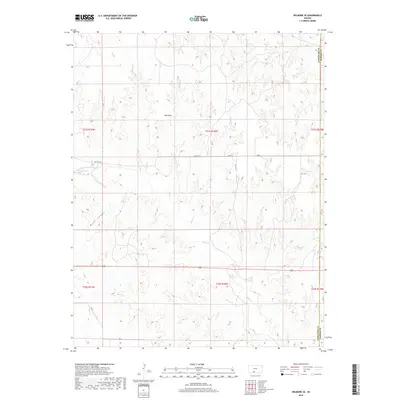
2018 Map of Wilmore SE
USGS Topo · Published 2018About this map
The Red Hills dominate this portion of the Kansas landscape, where a dense network of intermittent drainage channels carves through the terrain of western Barber County and eastern Comanche County. This 2018 survey reveals a topography defined by erosion, most notably within Baker Canyon in the southwest and along the numerous creeks that feed the regional watershed. Local travel is primarily served by unpaved routes such as Sun City Rd and Ave E, which navigate the high ground between the various draws.
Find a feature on this map
25 named features on this map. Tap any name to fly to it.
Don’t see what you’re looking for? This feature index may not catch every label — zoom into the map to look around manually.
Map Details
Editions of this 2018 Wilmore SE Map
This is the sole edition of this map. No revisions or reprints were ever made.
Other maps of this area

1891 · Medicine Lodge
USGS Topo · 1:125,000

1892 · Coldwater
USGS Topo · 1:125,000

1893 · Medicine Lodge
USGS Topo · 1:125,000

1955 · Pratt
USGS Topo · 1:250,000

1959 · Pratt
USGS Topo · 1:250,000

1968 · Sun City SW
USGS Topo · 1:24,000
1968 · Sun City
USGS Topo · 1:24,000

1968 · Wilmore SE
USGS Topo · 1:24,000

1968 · Belvidere
USGS Topo · 1:24,000
1973 · Deerhead
USGS Topo · 1:24,000