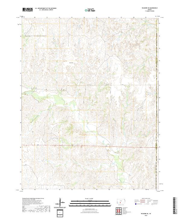
2022 Map of Wilmore SE
USGS Topo · Published 2022About this map
The Red Hills rise across this section of southern Kansas, where the border between Comanche and Barber counties meets. This landscape is defined by a dendritic network of drainage creeks including Mule Cr, Horse Cr, and Walnut Cr, which carve through the distinct red Permian rock of the region. The map reveals the deeply etched Baker Canyon in the southwest, contrasting with the more open drainage basins of Skelton Cr and Dunlap Cr to the north.
Find a feature on this map
25 named features on this map. Tap any name to fly to it.
Don’t see what you’re looking for? This feature index may not catch every label — zoom into the map to look around manually.
Map Details
Editions of this 2022 Wilmore SE Map
This is the sole edition of this map. No revisions or reprints were ever made.
Other maps of this area

1891 · Medicine Lodge
USGS Topo · 1:125,000

1892 · Coldwater
USGS Topo · 1:125,000

1893 · Medicine Lodge
USGS Topo · 1:125,000

1955 · Pratt
USGS Topo · 1:250,000

1959 · Pratt
USGS Topo · 1:250,000

1968 · Sun City SW
USGS Topo · 1:24,000
1968 · Sun City
USGS Topo · 1:24,000

1968 · Wilmore SE
USGS Topo · 1:24,000

1968 · Belvidere
USGS Topo · 1:24,000
1973 · Deerhead
USGS Topo · 1:24,000