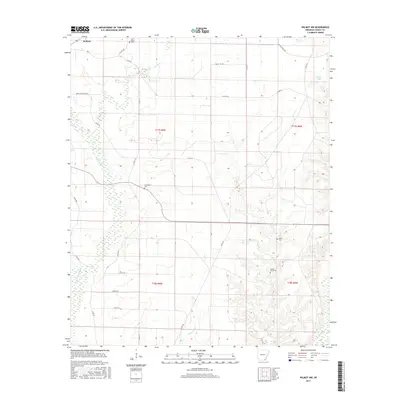
2017 Map of Wilmot NW
USGS Topo · Published 2017About this map
Wallace stands at the northwestern corner of this Ashley County landscape, where the flat alluvial topography of the Mississippi Delta is defined by an intricate network of waterways and rural county roads. The drainage pattern is established by Haley Cr and Beech Cr, which wind through a patchwork of agricultural plots and low-lying wetlands. Local history and genealogy are anchored by several small burial grounds scattered across the townships, including New Texas Cem in the north and Cleveland Cem situated near the center of the quadrangle. Southward, the terrain follows the course of White Oak Cr, while the eastern portion of the sheet shows the area around Young Lake. The transition between T17S and T18S reflects the orderly grid of the Public Land Survey System, providing a clear spatial context for researchers tracing family landholdings near Hogue Cem and Beech Creek Cem.
Find a feature on this map
34 named features on this map. Tap any name to fly to it.
Don’t see what you’re looking for? This feature index may not catch every label — zoom into the map to look around manually.
Map Details
Editions of this 2017 Wilmot NW Map
This is the sole edition of this map. No revisions or reprints were ever made.
Other maps of this area

1935 · Mist
USGS Topo · 1:62,500

1935 · Wilmot
USGS Topo · 1:62,500

1952 · Fountain Hill
USGS Topo · 1:24,000

1953 · Greenwood
USGS Topo · 1:250,000

1956 · Greenwood
USGS Topo · 1:250,000

1960 · Snyder
USGS Topo · 1:24,000

1960 · Mist
USGS Topo · 1:62,500

1960 · Wilmot
USGS Topo · 1:62,500
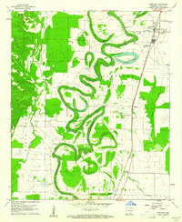
1960 · Portland
USGS Topo · 1:24,000

1960 · Wilmot NW
USGS Topo · 1:24,000