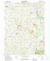
1961 Map of Wilmot
USGS Topo · Published 1992About this map
The Greenville Treaty Line bisects the southern portion of this landscape, marking a significant historical boundary in the settlement of the Ohio frontier. Centered on the junction of Wayne, Stark, and Holmes counties, the area features a dense network of family-named landmarks and rural institutions during the early 1960s. Small agricultural hubs like Mount Eaton and Wilmot are surrounded by numerous community centers, including Beach Grove Sch and Longenecker Ch.
Find a feature on this map
47 named features on this map. Tap any name to fly to it.
Don’t see what you’re looking for? This feature index may not catch every label — zoom into the map to look around manually.
Map Details
Editions of this 1961 Wilmot Map
Other maps of this area

1901 · Massillon
USGS Topo · 1:62,500

1901 · Wooster
USGS Topo · 1:62,500

1903 · Massillon
USGS Topo · 1:62,500

1903 · Wooster
USGS Topo · 1:62,500

1914 · Navarre
USGS Topo · 1:62,500

1915 · Millersburg
USGS Topo · 1:62,500

1943 · Millersburg
USGS Topo · 1:62,500

1944 · Navarre
USGS Topo · 1:62,500

1951 · Canton
USGS Topo · 1:250,000

1953 · Canton
USGS Topo · 1:250,000