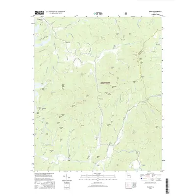
2017 Map of Wilscot
USGS Topo · Published 2017About this map
Morganton and the upper reaches of Blue Ridge Lake define the northwestern corner of this landscape, where the waters of Star Cr feed into the reservoir. Moving southeast, the terrain transitions into the dense woodlands of the Chattahoochee National Forest, a region defined by high peaks like Picklesimer Mtn and Tipton Mtn. The Toccoa River snakes through the southern portion of the map, passing the small settlements of Dial and Margret. Family history is deeply etched into this geography through numerous burial sites, including the Van Zandt Cem, Brawley Cem, and Griffith Cem. The transportation network relies on winding mountain passes like Wilscot Gap and Skeenhah Gap, which connect the dispersed communities of Hurst and Swan across the Fannin and Union county line.
Find a feature on this map
136 named features on this map. Tap any name to fly to it.
Don’t see what you’re looking for? This feature index may not catch every label — zoom into the map to look around manually.
Map Details
Editions of this 2017 Wilscot Map
This is the sole edition of this map. No revisions or reprints were ever made.
Other maps of this area

1888 · Ellijay
USGS Topo · 1:125,000

1892 · Ellijay
USGS Topo · 1:125,000

1898 · Ellijay
USGS Topo · 1:125,000

1911 · Ellijay
USGS Topo · 1:125,000

1935 · Ivylog
USGS Topo · 1:24,000

1935 · Mulky Gap
USGS Topo · 1:24,000

1935 · Noontootla
USGS Topo · 1:24,000

1935 · Mineral Bluff
USGS Topo · 1:24,000

1935 · Lake Toccoa
USGS Topo · 1:24,000

1935 · Tickanetley
USGS Topo · 1:24,000