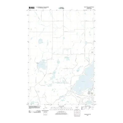
2010 Map of Wilson Bay
USGS Topo · Published 2010About this map
Glacial lakes and resort-style recreation dominate this pocket of Cass County, where the expansive waters of Gull Lake meet a landscape carved by winding waterways like Rush Brook and Home Brook. The area's character as a destination for leisure is evident in the cluster of athletic grounds on the peninsula, including Madden's Social Nine Golf Course and Madden's Pine Beach East Golf Course. Inland, a high density of smaller basins such as Dead Horse Lake, Green Bass Lake, and Beauty Lake are connected by a network of local roads like County Hwy-77 SW and Beauty Lake Rd SW. The presence of the Gull Lake Lookout Tower and Rock Lake Campground highlights the area's integration of natural resource management and public outdoor access. This environment shows a distinct transition from the larger open waters in the southeast to the more secluded, swampy margins found near Stump Lake and Burned Camp Lake.
Find a feature on this map
50 named features on this map. Tap any name to fly to it.
Don’t see what you’re looking for? This feature index may not catch every label — zoom into the map to look around manually.
Map Details
Editions of this 2010 Wilson Bay Map
This is the sole edition of this map. No revisions or reprints were ever made.
Other maps of this area

1916 · Pillager
USGS Topo · 1:62,500

1919 · Pillager
USGS Topo · 1:62,500

1919 · Leader
USGS Topo · 1:62,500

1953 · Brainerd
USGS Topo · 1:250,000

1954 · Baxter
USGS Topo · 1:24,000

1954 · Pillager
USGS Topo · 1:24,000

1957 · Brainerd
USGS Topo · 1:250,000

1958 · Brainerd
USGS Topo · 1:250,000

1959 · Nisswa
USGS Topo · 1:24,000

1959 · Pine River SW
USGS Topo · 1:24,000