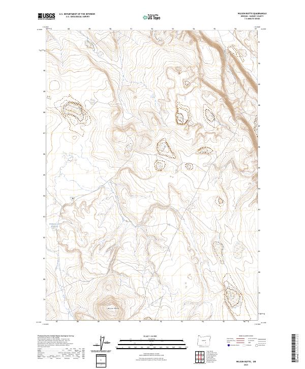
2023 Map of Wilson Butte
USGS Topo · Published 2023About this map
Wilson Butte anchors this high-desert landscape in Harney County, rising above a network of drainages and seasonal water features. The terrain is defined by the sharp relief of the butte and the presence of Wildhorse Lake Reservoir in the western reaches of the quadrangle. Flowing south from the reservoir, the seasonal path of Wilson Creek cuts through the Public Land Survey System grids of t27s r26e and t28s r26e. This 2023 survey illustrates the sparse, high-elevation character of this corner of Oregon, where water management and topography dictate the land use. The map provides a detailed view of the township and range boundaries, including t27s r27e and t28s r27e, which are essential for property and resource tracking in this expansive environment.
Find a feature on this map
7 named features on this map. Tap any name to fly to it.
Don’t see what you’re looking for? This feature index may not catch every label — zoom into the map to look around manually.
Map Details
Editions of this 2023 Wilson Butte Map
This is the sole edition of this map. No revisions or reprints were ever made.
Other maps of this area

1955 · Burns
USGS Topo · 1:250,000

1958 · Burns
USGS Topo · 1:250,000

1959 · Burns
USGS Topo · 1:250,000

1980 · Lunch Lake
USGS Topo · 1:24,000
1980 · Flybee Lake
USGS Topo · 1:24,000

1980 · Iron Mtn. Flat
USGS Topo · 1:24,000

1980 · Alec Butte
USGS Topo · 1:24,000

1980 · Lake on The Trail
USGS Topo · 1:24,000
1984 · Dry Valley Rim
USGS Topo · 1:24,000
1984 · Goose Egg Butte
USGS Topo · 1:24,000