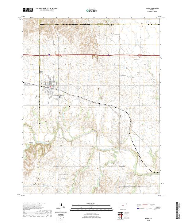
2022 Map of Wilson
USGS Topo · Published 2022About this map
Wilson serves as the primary hub of this Central Kansas landscape, situated at the intersection of a grid-iron road network and several notable watercourses. The town's Czech heritage and local history are evident in the clustering of burial sites south of the main settlement, including Wilson Cem, the Saint Wenceslaus Catholic Cem, and the Old Wilson Cem. This concentration of cemeteries provides a significant footprint for genealogical research, documenting the generations of families who settled the area.
Find a feature on this map
51 named features on this map. Tap any name to fly to it.
Don’t see what you’re looking for? This feature index may not catch every label — zoom into the map to look around manually.
Map Details
Editions of this 2022 Wilson Map
This is the sole edition of this map. No revisions or reprints were ever made.
Other maps of this area

1894 · Ellsworth
USGS Topo · 1:125,000

1896 · Russell
USGS Topo · 1:125,000

1955 · Great Bend
USGS Topo · 1:250,000

1956 · Wilson
USGS Topo · 1:24,000

1956 · Dorrance
USGS Topo · 1:24,000

1957 · Great Bend
USGS Topo · 1:250,000

1957 · Holyrood NE
USGS Topo · 1:24,000

1957 · Black Wolf
USGS Topo · 1:24,000

1958 · Great Bend
USGS Topo · 1:250,000
1964 · Wilson NW
USGS Topo · 1:24,000