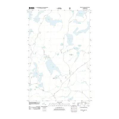
2011 Map of Wilson Lake
USGS Topo · Published 2011About this map
Wanless sits at the junction of the southern forest routes, anchoring a landscape defined by an intricate network of timber-era infrastructure and water management. The terrain is marked by multiple water control points, including the Wilson Lake Dam, Cross River Number Three Dam, and Dam Five Lake Dam, indicating a legacy of industrial or recreational water level regulation. Transportation in this corner of Cook County is shaped by historic pathways such as The Grade and 4 Mile Grade Rd, which likely reflect former logging rail beds converted for modern access. Numerous water bodies like Wilson Lake, Whitefish Lake, and Silver Island Lake are interconnected by systems like Houghtaling Creek and the Cross River. This 2011 survey captures the area's transition into a managed wilderness, where the Wanless Trl and various designated forest routes provide the primary means of navigating the dense lake country.
Find a feature on this map
47 named features on this map. Tap any name to fly to it.
Don’t see what you’re looking for? This feature index may not catch every label — zoom into the map to look around manually.
Map Details
Editions of this 2011 Wilson Lake Map
This is the sole edition of this map. No revisions or reprints were ever made.
Other maps of this area

1954 · Two Harbors
USGS Topo · 1:250,000

1955 · Schroeder
USGS Topo · 1:24,000

1955 · Tofte
USGS Topo · 1:62,500

1955 · Cramer
USGS Topo · 1:62,500

1957 · Two Harbors
USGS Topo · 1:250,000

1958 · Two Harbors
USGS Topo · 1:250,000

1960 · Kawishiwi Lake
USGS Topo · 1:24,000

1960 · Perent Lake
USGS Topo · 1:24,000

1960 · Beth Lake
USGS Topo · 1:24,000

1964 · Two Harbors
USGS Topo · 1:250,000