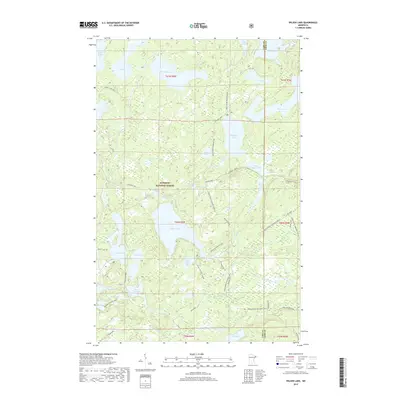
2019 Map of Wilson Lake
USGS Topo · Published 2019About this map
The dense lake district of the Superior National Forest dominates this landscape, straddling the border between Lake and Cook counties. Central to the area is Wilson Lake, supported by the Wilson Lake Boat Landing and a series of smaller interconnected water bodies like Little Wilson Lake, Sister Lake, and Dam Five Lake. The region is defined by its complex hydrography, where the Cross River and numerous tributaries such as Wanless Cr, Wilson Cr, and Fourmile Cr wind through a terrain marked by glacial depressions.
Find a feature on this map
59 named features on this map. Tap any name to fly to it.
Don’t see what you’re looking for? This feature index may not catch every label — zoom into the map to look around manually.
Map Details
Editions of this 2019 Wilson Lake Map
This is the sole edition of this map. No revisions or reprints were ever made.
Other maps of this area

1954 · Two Harbors
USGS Topo · 1:250,000

1955 · Schroeder
USGS Topo · 1:24,000

1955 · Tofte
USGS Topo · 1:62,500

1955 · Cramer
USGS Topo · 1:62,500

1957 · Two Harbors
USGS Topo · 1:250,000

1958 · Two Harbors
USGS Topo · 1:250,000

1960 · Kawishiwi Lake
USGS Topo · 1:24,000

1960 · Perent Lake
USGS Topo · 1:24,000

1960 · Beth Lake
USGS Topo · 1:24,000

1964 · Two Harbors
USGS Topo · 1:250,000