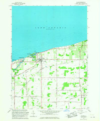
1965 Map of Wilson
USGS Topo · Published 1968About this map
Lake Ontario defines the northern edge of this Niagara County landscape, where the village of Wilson sits at the mouth of Twelvemile Creek. The mid-1960s shoreline is marked by seasonal and residential clusters including Sunset Beach, Roosevelt Beach, and Coolidge Beach, centered around the protected waters of Tuscarora Bay. This bay serves as a focal point for local recreation and infrastructure, featuring Tuscarora Park and a nearby Sewage Disposal plant. Inland, the landscape transitions to a rural agricultural pattern defined by a grid of local roads like Daniels Road and Shadigee Road. Historical social centers are well-preserved in this record, including the Concordia Ch and Marks Sch, alongside family-named landmarks and the Lakeview Airport. The presence of the New York Central Road corridor reflects the era's established transportation network connecting the lakeside community to the broader region.
Find a feature on this map
31 named features on this map. Tap any name to fly to it.
Don’t see what you’re looking for? This feature index may not catch every label — zoom into the map to look around manually.
Map Details
Editions of this 1965 Wilson Map
This is the sole edition of this map. No revisions or reprints were ever made.
Other maps of this area

1894 · Wilson
USGS Topo · 1:62,500

1897 · Tonawanda
USGS Topo · 1:62,500

1897 · Olcott
USGS Topo · 1:62,500

1897 · Lockport
USGS Topo · 1:62,500

1899 · Niagara
USGS Topo · 1:125,000

1900 · Wilson
USGS Topo · 1:62,500

1900 · Tonawanda
USGS Topo · 1:62,500

1901 · Tonawanda
USGS Topo · 1:62,500

1902 · Lockport
USGS Topo · 1:62,500

1905 · Lockport
USGS Topo · 1:62,500