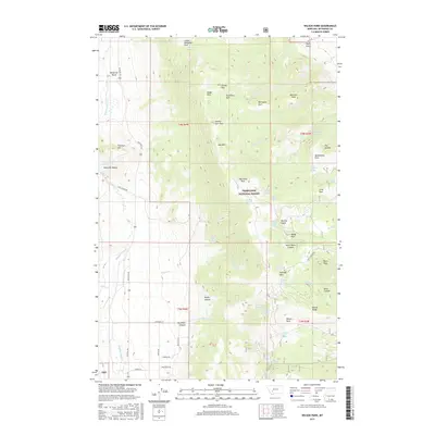
2017 Map of Wilson Park
USGS Topo · Published 2017About this map
Deerlodge National Forest dominates this Montana landscape, where the high country of the Boulder Mountains meets deep drainages. Significant topographic features like Bull Mtn and Fletcher Mtn overlook a series of natural basins and parks, including the oddly named Seldom Seen Park and Little Whitetail Park. The hydrology of the region is defined by the headwaters of Dearborn Cr and Whitetail Deer Cr, with numerous mountain springs like Big Chief Spring and Swampy Park Spring fueling the local watersheds. Water management is evident through features such as Keogh Reservoir and Moulton Reservoir. The network of forest roads and trails, including Hay Canyon Rd and Wapiti Rd, reveals a modern landscape managed for timber and recreation, yet deeply rooted in its traditional canyon geography such as Dearborn Canyon and Dunn Canyon.
Find a feature on this map
65 named features on this map. Tap any name to fly to it.
Don’t see what you’re looking for? This feature index may not catch every label — zoom into the map to look around manually.
Map Details
Editions of this 2017 Wilson Park Map
This is the sole edition of this map. No revisions or reprints were ever made.
Other maps of this area

1886 · Fort Logan
USGS Topo · 1:250,000

1888 · Three Forks
USGS Topo · 1:250,000

1889 · Helena
USGS Topo · 1:250,000

1893 · Helena
USGS Topo · 1:250,000

1893 · Dillon
USGS Topo · 1:250,000

1894 · Three Forks
USGS Topo · 1:250,000

1895 · Three Forks
USGS Topo · 1:250,000

1899 · Boulder
USGS Topo · 1:125,000

1899 · Helena
USGS Topo · 1:250,000

1903 · Helena
USGS Topo · 1:250,000