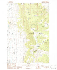
1985 Map of Wilson Park
USGS Topo · Published 1986About this map
Deerlodge National Forest dominates this mountain landscape, where the Bull Mountain Range rises above the broad Whitetail Valley. The topography is defined by high-elevation meadows known locally as parks, including the curiously named Seldom Seen Park and Two Pines Park. These openings in the timber often correspond with vital water sources such as Wilson Park Spring and Maggot Spring, which would have been critical waypoints for early forest rangers and livestock grazers.
Find a feature on this map
49 named features on this map. Tap any name to fly to it.
Don’t see what you’re looking for? This feature index may not catch every label — zoom into the map to look around manually.
Map Details
Editions of this 1985 Wilson Park Map
This is the sole edition of this map. No revisions or reprints were ever made.
Other maps of this area

1886 · Fort Logan
USGS Topo · 1:250,000

1888 · Three Forks
USGS Topo · 1:250,000

1889 · Helena
USGS Topo · 1:250,000

1893 · Helena
USGS Topo · 1:250,000

1893 · Dillon
USGS Topo · 1:250,000

1894 · Three Forks
USGS Topo · 1:250,000

1895 · Three Forks
USGS Topo · 1:250,000

1899 · Boulder
USGS Topo · 1:125,000

1899 · Helena
USGS Topo · 1:250,000

1903 · Helena
USGS Topo · 1:250,000