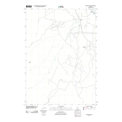
2010 Map of Wilson Peak
USGS Topo · Published 2010About this map
Wilson serves as the primary focal point of this southwestern Idaho landscape, situated where the high desert terrain begins its ascent toward the prominent Wilson Peak. The geographic character of the area is defined by the vital water systems of the Snake River at the northeastern corner and the winding courses of Wilson Creek and Reynolds Creek. Human settlement and agricultural development are etched into the land through an intricate network of irrigation and access, notably the Bernard Ditch and the aptly named China Ditch Rd.
Find a feature on this map
16 named features on this map. Tap any name to fly to it.
Don’t see what you’re looking for? This feature index may not catch every label — zoom into the map to look around manually.
Map Details
Editions of this 2010 Wilson Peak Map
This is the sole edition of this map. No revisions or reprints were ever made.
Other maps of this area

1892 · Silver City
USGS Topo · 1:125,000

1894 · Silver City
USGS Topo · 1:125,000

1898 · Silver City
USGS Topo · 1:125,000

1955 · Boise
USGS Topo · 1:250,000
1957 · Walters Butte
USGS Topo · 1:24,000

1957 · Opalene Gulch
USGS Topo · 1:24,000

1957 · Wilson Peak
USGS Topo · 1:24,000

1957 · Sands Basin
USGS Topo · 1:62,500

1958 · Boise
USGS Topo · 1:250,000
1958 · Givens Hot Springs
USGS Topo · 1:24,000