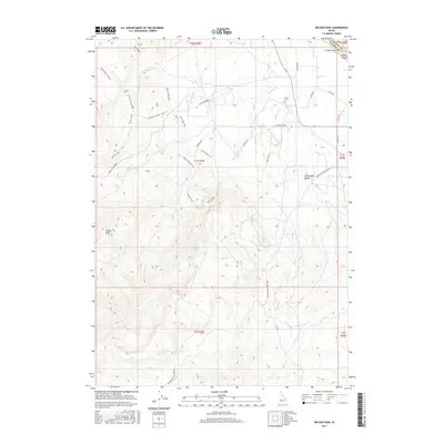
2017 Map of Wilson Peak
USGS Topo · Published 2017About this map
Wilson Peak rises as the prominent landmark in this desert landscape near the border of Canyon and Owyhee counties. The terrain is defined by a sophisticated network of recreational paths and water management systems. Modern trail systems such as the W250 Multi-Use Trail, Rabbits Revenge Trail, and Cabroilite Trail wind through the hills, while agricultural history is evident in the irrigation works of Bernard Ditch, Beck's Ditch, and the China Ditch Rd. Along the northern edge, Wright Island and Bayha Island sit within the complex waterways near Map Rock Rd. Local history is anchored by the Wilson Cem, located near the intersection of Johnston Ln and Youngs Ln. This 2017 survey illustrates the continued importance of the Wilson Creek and Reynolds Cr drainages for both recreation and ranching infrastructure.
Find a feature on this map
37 named features on this map. Tap any name to fly to it.
Don’t see what you’re looking for? This feature index may not catch every label — zoom into the map to look around manually.
Map Details
Editions of this 2017 Wilson Peak Map
This is the sole edition of this map. No revisions or reprints were ever made.
Other maps of this area

1892 · Silver City
USGS Topo · 1:125,000

1894 · Silver City
USGS Topo · 1:125,000

1898 · Silver City
USGS Topo · 1:125,000

1955 · Boise
USGS Topo · 1:250,000
1957 · Walters Butte
USGS Topo · 1:24,000

1957 · Opalene Gulch
USGS Topo · 1:24,000

1957 · Wilson Peak
USGS Topo · 1:24,000

1957 · Sands Basin
USGS Topo · 1:62,500

1958 · Boise
USGS Topo · 1:250,000
1958 · Givens Hot Springs
USGS Topo · 1:24,000