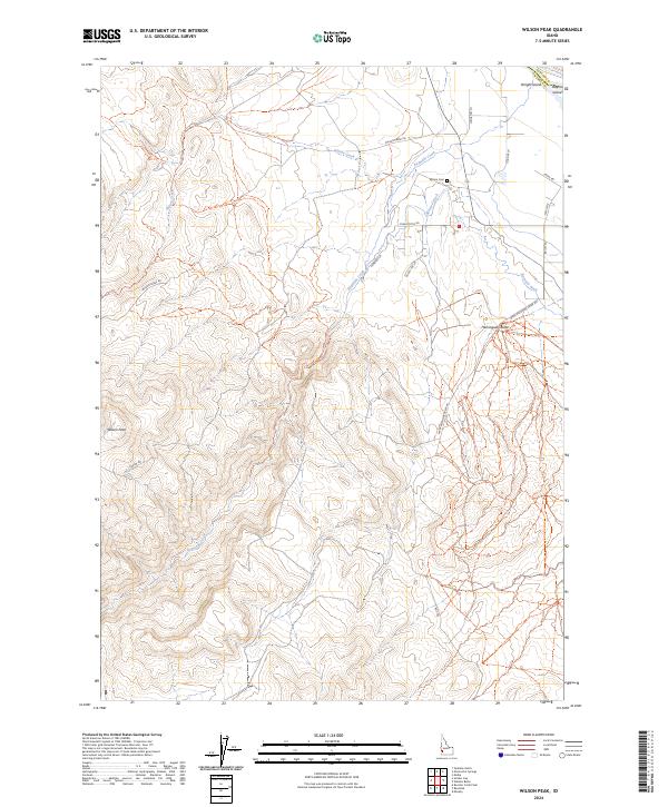
2024 Map of Wilson Peak
USGS Topo · Published 2024About this map
Wilson Peak and Hemingway Butte define the topography of this Owyhee County landscape, where the high desert terrain meets the managed water systems of the Snake River valley. The northern edge of the map reveals a critical riparian habitat preserved within the Deer Flat National Wildlife Refuge, featuring Wright Island and Bayha Island. Irrigation infrastructure is central to the area's development, evidenced by the Bernard Ditch and China Ditch, which redirect flow across the plains near Reynolds Creek. Local history is anchored at the Wilson Cem, located off Wilson Creek Rd. The network of local routes like Cemetery Ln, China Ditch Rd, and Youngs Ln connects remote ranching or agricultural outposts to the primary watercourses of Wilson Creek and its surrounding foothills.
Find a feature on this map
31 named features on this map. Tap any name to fly to it.
Don’t see what you’re looking for? This feature index may not catch every label — zoom into the map to look around manually.
Map Details
Editions of this 2024 Wilson Peak Map
This is the sole edition of this map. No revisions or reprints were ever made.
Other maps of this area

1892 · Silver City
USGS Topo · 1:125,000

1894 · Silver City
USGS Topo · 1:125,000

1898 · Silver City
USGS Topo · 1:125,000

1955 · Boise
USGS Topo · 1:250,000
1957 · Walters Butte
USGS Topo · 1:24,000

1957 · Opalene Gulch
USGS Topo · 1:24,000

1957 · Wilson Peak
USGS Topo · 1:24,000

1957 · Sands Basin
USGS Topo · 1:62,500

1958 · Boise
USGS Topo · 1:250,000
1958 · Givens Hot Springs
USGS Topo · 1:24,000