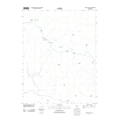
2012 Map of Wilson Valley
USGS Topo · Published 2012About this map
Cache Creek serves as the primary drainage through this corner of Yolo County, winding through a complex geography of ridges and named flats. The landscape is defined by its numerous branching canyons, such as Judge Davis Canyon and Petrified Canyon, which descend toward the central Wilson Valley. Higher elevations are marked by distinctive landmarks including Grizzly Peak and the Twin Sisters to the south. This 2012 survey illustrates the remote character of the region, where infrastructure is limited to long-standing corridors like Rocky Creek Rd and Morgan Valley Rd. The distribution of water sources, from Dunfield Spring in the north to Bear Spring near Butte Rock, suggests the importance of reliable water in this upland environment, where Kennedy Flats and Dunfield Flats provide rare stretches of level ground among the hills.
Find a feature on this map
31 named features on this map. Tap any name to fly to it.
Don’t see what you’re looking for? This feature index may not catch every label — zoom into the map to look around manually.
Map Details
Editions of this 2012 Wilson Valley Map
This is the sole edition of this map. No revisions or reprints were ever made.
Other maps of this area

1920 · Venado
USGS Topo · 1:62,500

1924 · Bartlett Springs
USGS Topo · 1:62,500

1942 · Bartlett Springs
USGS Topo · 1:62,500

1943 · Morgan Valley
USGS Topo · 1:62,500

1944 · Bartlett Springs
USGS Topo · 1:62,500

1944 · Wilbur Springs
USGS Topo · 1:62,500

1944 · Morgan Valley
USGS Topo · 1:62,500

1945 · Lower Lake
USGS Topo · 1:62,500

1947 · Santa Rosa
USGS Topo · 1:250,000

1949 · Santa Rosa
USGS Topo · 1:250,000