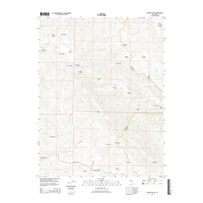
2015 Map of Wilson Valley
USGS Topo · Published 2015About this map
Wilson Valley is defined by the winding course of Cache Creek, which carves through a landscape of named flats and steep ridges at the intersection of Colusa, Lake, and Yolo counties. This 2015 topography reveals a network of canyons including Thompson Canyon, Judge Davis Canyon, and Crack Canyon, interspersed with landmarks like Round Mtn and Butte Rock. The southern portion is marked by the small settlement of Morgan Valley and high points such as Grizzly Peak and the Twin Sisters. The presence of several springs, such as Bear Spring and Dunfield Spring, indicates the drainage patterns that sustain this environment. Isolated features like The Peninsula and Buck Island suggest the complex relief of the creek beds, while roads like Morgan Valley Rd provide the primary access through this remote section of the Inner Coast Ranges.
Find a feature on this map
45 named features on this map. Tap any name to fly to it.
Don’t see what you’re looking for? This feature index may not catch every label — zoom into the map to look around manually.
Map Details
Editions of this 2015 Wilson Valley Map
This is the sole edition of this map. No revisions or reprints were ever made.
Other maps of this area

1920 · Venado
USGS Topo · 1:62,500

1924 · Bartlett Springs
USGS Topo · 1:62,500

1942 · Bartlett Springs
USGS Topo · 1:62,500

1943 · Morgan Valley
USGS Topo · 1:62,500

1944 · Bartlett Springs
USGS Topo · 1:62,500

1944 · Wilbur Springs
USGS Topo · 1:62,500

1944 · Morgan Valley
USGS Topo · 1:62,500

1945 · Lower Lake
USGS Topo · 1:62,500

1947 · Santa Rosa
USGS Topo · 1:250,000

1949 · Santa Rosa
USGS Topo · 1:250,000