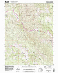
1998 Map of Wilson Valley
USGS Topo · Published 2002About this map
Cache Creek winds through the heart of this landscape, carving a deep path through the canyon lands of the northern California interior. In the late 20th century, this area remained largely defined by its natural drainage systems and dramatic topography, with Wilson Valley and Morgan Valley providing the few relatively level stretches of ground amidst the ridges. The map reveals a network of water sources such as Dunfield Spring and Bear Spring that were vital for any historical activity in these hills.
Find a feature on this map
42 named features on this map. Tap any name to fly to it.
Don’t see what you’re looking for? This feature index may not catch every label — zoom into the map to look around manually.
Map Details
Editions of this 1998 Wilson Valley Map
This is the sole edition of this map. No revisions or reprints were ever made.
Other maps of this area

1920 · Venado
USGS Topo · 1:62,500

1924 · Bartlett Springs
USGS Topo · 1:62,500

1942 · Bartlett Springs
USGS Topo · 1:62,500

1943 · Morgan Valley
USGS Topo · 1:62,500

1944 · Bartlett Springs
USGS Topo · 1:62,500

1944 · Wilbur Springs
USGS Topo · 1:62,500

1944 · Morgan Valley
USGS Topo · 1:62,500

1945 · Lower Lake
USGS Topo · 1:62,500

1947 · Santa Rosa
USGS Topo · 1:250,000

1949 · Santa Rosa
USGS Topo · 1:250,000